On a dull February morning, when the sky hangs low and heavy, meteorologists quietly began raising concerns. Far above the Arctic, nearly 30 kilometers overhead, the polar vortex — a massive band of frigid winds that normally spins steadily — started to lose its balance. Weather models, usually predictable streams of data, suddenly burst into vivid warning patterns.
Forecast centers from Washington to Berlin began exchanging messages. Screenshots circulated. Phrases like “exceptionally strong disruption” and “rare February event” appeared in internal discussions.
At street level, life went on as usual. Jackets were zipped. Weather apps showed nothing more than light rain.

A fractured weather engine in the upper atmosphere
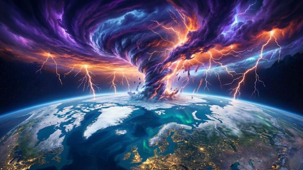
The polar vortex acts as winter’s control system. It’s a powerful river of icy air looping the North Pole, typically compact and stable, holding the harshest cold far to the north.

Right now, that system is absorbing a major shock. Scientists are observing a sudden stratospheric warming — an intense surge of heat that slams into the vortex and begins pulling it apart. Temperatures high in the stratosphere are rising by 40 to 50°C in just days.
On forecast maps, the once-smooth ring of cold is now warping, splitting, and drifting southward.
Many people remember the polar vortex from past headline-making winters, when Arctic air paralyzed cities across North America and Europe. During the 2013–2014 winter, for instance, Chicago experienced colder temperatures than parts of Antarctica, flights were canceled en masse, and schools shut down for days.
This year stands apart. Experts say the current February disruption is unusually intense and structurally extreme. Major forecasting agencies, including ECMWF in Europe and NOAA in the United States, are tracking some of the most dramatic high-altitude changes seen in more than ten years.
It’s like watching a massive spinning top start to wobble violently after appearing perfectly stable.
How a disrupted polar vortex affects everyday weather
So what does a fractured vortex mean for your neighborhood, your commute, or your heating costs? When the vortex weakens this severely, it can unlock Arctic cold and allow it to spill south in uneven waves.
This often leads to blocked weather patterns over Greenland, stalled Atlantic storms, or sudden cold surges across Europe, Asia, or North America. In some cases, regions endure weeks of persistent cold. In others, weather swings sharply — mild days followed by icy conditions.
The essential takeaway is simple: when the polar vortex breaks down this forcefully, normal weather patterns become unpredictable.
Practical ways to prepare for sudden weather shifts
You can’t influence the polar vortex from home, but you can adapt to the weather volatility it creates. For the next four to six weeks, it helps to assume local forecasts may change quickly.
If you live in a cold-prone area, keep winter layers and essentials within reach, rather than packing them away because spring feels close. Make sure power banks are charged. Store basic supplies — shelf-stable food, water, and necessary medications — in case ice or wet snow disrupts power.
 Goodbye Hair Dye for Grey Hair: The Conditioner Add-In That Gradually Restores Natural Colour
These small, routine preparations often matter far more than dramatic headlines.
Most people have experienced how a forecasted “light snow” can suddenly become a travel nightmare. With a disturbed vortex overhead, those surprises become more likely.
Common pitfalls include relying solely on weather icons instead of reading detailed forecasts, or assuming February’s longer days mean winter risks have passed. In a year like this, paying attention to details such as wind strength, ice risk, and rapid temperature drops can prevent uncomfortable surprises.
What forecasters are emphasizing right now
Meteorologists are trying to avoid unnecessary alarm, but they acknowledge this event is genuinely uncommon.
A senior atmospheric scientist at a European forecasting center explains that from a stratospheric viewpoint, this is a classic major disruption capable of reshaping surface weather for weeks. While no one can pinpoint exact local impacts, the conditions favor extreme variability.
- Track 5–10 day trends rather than focusing only on tomorrow’s forecast.
- Rely on one trusted official weather source, not viral maps.
- Plan using scenarios, such as alternate commutes or school arrangements.
- Prepare for both cold snaps and heavy, wet snow that can damage infrastructure.
- Stay flexible with travel and outdoor plans as warnings evolve.
A signal of a changing climate backdrop
What makes this February’s disruption especially unsettling is the broader context. Arctic sea ice in some regions remains below average, global oceans are unusually warm, and the planet has recently recorded multiple record-hot months.
Scientists continue debating how climate change influences the polar vortex, but a growing body of research suggests that a warmer, less stable Arctic may be encouraging more erratic stratospheric behavior. Not every disruption causes severe cold; some bring mild conditions to certain areas while others face intense freezes.
The pattern is complex, but the message is clear: seasonal predictability is weakening.
Meanwhile, daily life still depends on practical concerns — school schedules, transport reliability, heating costs, and power stability. The atmosphere doesn’t account for these realities. Communities do.
This may be the year people communicate more with neighbors, read weather alerts carefully, and teach younger generations that forecasts are probabilities, not promises.
The disruption will eventually fade. The vortex will reorganize and spin once more. Still, this strange February — marked by a breaking winter engine high above while early flowers push through the soil — may linger as a quiet reminder.
The invisible systems shaping our weather are changing faster than our routines on the ground.

Key points at a glance
- Unusually strong vortex disruption: A major sudden stratospheric warming is breaking apart the polar vortex, explaining rapidly shifting forecasts.
- Delayed and uneven impacts: Surface effects often appear over one to three weeks and vary widely by region.
- Low-stress preparation matters: Monitoring trends and staying ready reduces disruption during abrupt cold or storm events.