The weather map on the meteorologist’s screen didn’t look right. Instead of the familiar February blues, deep red swirls stretched across the Arctic, with warm tendrils creeping north like smudged paint. Inside the cramped forecast office, mugs of coffee were forgotten as experts replayed the animation again and again, watching stratospheric winds over the North Pole bend, weaken, and finally break.
At street level, winter felt strangely gentle. Puddles shimmered where snowbanks should be, dogs strained at their leashes, and children skipped hats entirely. Yet far above, tens of kilometers overhead, the atmosphere was quietly setting the stage for what could come next.
Something rare is happening in the sky.

A polar vortex disruption unlike the usual pattern
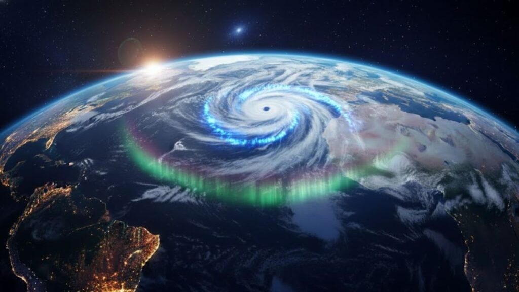
On standard weather charts, the polar vortex appears as a tight ring of frigid winds circling the Arctic, acting as an invisible barrier that keeps bitter cold locked in place. This February, that barrier is under attack from above. Bursts of high-altitude warmth are surging into the stratosphere, slowing the powerful winds and tearing apart what is normally a stable circulation.

Scientists call this phenomenon a sudden stratospheric warming (SSW), a technical term that barely captures how unusual this event appears. Monitoring teams report it is not only early and rapid, but also exceptionally strong. Words like “dramatic” are surfacing in discussions that are typically measured and cautious.
To visualize it, imagine the polar vortex as a spinning top. In most winters, it may wobble slightly but keeps turning. This time, the top is being struck hard from the side. Forecasts suggest it could slow sharply, split apart, or even reverse direction high above the pole.
One major European forecast model now indicates a full reversal of the usual westerly stratospheric winds, a defining marker of a major SSW. This doesn’t happen every year. When it does, its influence can linger at the surface for weeks or even longer.
This is where the science becomes relevant to everyday life. When the polar vortex weakens or fractures, pockets of intense Arctic cold can slip south from their typical confines. Elsewhere, conditions may flip toward unexpected warmth or dryness.
Not every SSW produces extreme weather everywhere. The atmosphere is complex and unpredictable. Still, major vortex disruptions tilt the odds toward stalled weather patterns, sharper contrasts, and prolonged conditions. This is why forecasters are paying such close attention, even if local forecasts still appear calm.
What this shift could mean at ground level
When the polar vortex is disrupted in the stratosphere, it’s like a wrench thrown into the gears of the atmospheric flow. Weather systems that normally race west to east may slow or stall. High-pressure blocks can settle in, steering cold air into some regions while others remain unseasonably mild.
Across North America and Europe, this often increases the likelihood of late-winter cold snaps, icy outbreaks, and abrupt temperature swings. One week may hint at spring, followed suddenly by conditions more typical of deep winter. This year’s event is unfolding in February, just as many people assume the harshest weather is behind them.
History offers a reminder. In February 2018, a powerful SSW unleashed frigid air across Europe, earning the nickname “Beast from the East”. Transportation ground to a halt, schools closed, and images of snow-covered coastlines spread rapidly online.
The current disruption is already being compared in strength to some of those standout winters. Early projections suggest a greater risk of blocked patterns over parts of the North Atlantic and Eurasia later in February and into March. That doesn’t guarantee a repeat, but it has drawn attention from experienced forecasters.
 A Major Polar Vortex Disruption Is Developing and Experts Say a February Event Like This Is Rare
From a physical standpoint, the process is straightforward but delayed. Energy from lower latitudes travels upward, warming the stratosphere and weakening the vortex. That disturbance then filters downward over days or weeks, gradually reshaping the jet stream closer to the surface.
So while the most dramatic changes may be happening high above the North Pole right now, their effects on daily weather often arrive later. One morning, the forecast suddenly looks colder, stormier, or strangely stuck. The trigger was pulled well before, far out of sight.
How to navigate an unsettled winter pattern
There’s no way to control a restless polar vortex, but there are ways to stay prepared. One is to watch for subtle language shifts in official forecasts. Mentions of “pattern changes” or an “increased risk of cold spells” often signal stratospheric influences at work.
Looking beyond tomorrow helps. Focus on 10-day trends and temperature swings rather than individual days. A rapid drop from mild to much colder conditions is often where disruptions are felt most strongly.
The impact isn’t only practical. Sudden weather changes can take a toll emotionally. False starts of spring followed by renewed cold create frustration and fatigue.
Small adjustments help. Keep transitional winter gear within reach. Plan flexibility into travel or outdoor events. If you’re sensitive to cold or pressure shifts, it helps to be prepared during these volatile weeks.
As one climate scientist recently noted, a strong sudden stratospheric warming doesn’t guarantee disruption everywhere, but it does mean the atmosphere’s probabilities have shifted for the rest of winter.
- Follow reliable updates from national weather services and local forecast offices.
- Think in weeks, not days, as impacts can unfold gradually.
- Expect contrasts, including cold snaps, icy precipitation, and brief warm spells.
- Plan with flexibility for travel and outdoor activities.
- Pay attention to personal well-being, as rapid weather swings can affect mood and energy.
A winter that refuses to follow the script
There’s something unsettling about a season that won’t behave as expected. Muddy February sidewalks one week can give way to late-season snowstorms the next. This year’s polar vortex disruption fits into a broader picture of less predictable patterns and sharper extremes.
Scientists remain cautious about linking any single event directly to climate change. At the same time, many acknowledge that a warmer global background can influence how these systems behave. Research continues into whether the polar vortex may become more prone to dramatic swings as Arctic conditions change.
What’s clear is that upper-atmosphere events matter more to daily life than once assumed. The distance between a stratospheric anomaly and a disrupted commute is shorter than it used to feel.
This February’s unusually strong disruption serves as a reminder that our idea of a “normal” winter is constantly shifting. Paying attention, staying adaptable, and acknowledging that uncertainty may be part of the season is becoming increasingly important as the atmosphere writes its own script.

| Key point | Detail | Value for the reader |
|---|---|---|
| Exceptionally strong February disruption | Major sudden stratospheric warming is slowing and possibly reversing polar vortex winds | Helps you understand why forecasters suddenly talk about “pattern changes” |
| Delayed but real surface impacts | Effects can show up weeks later as cold snaps, blocked patterns, and weather whiplash | Encourages planning beyond the 48‑hour forecast window |
| Everyday strategies to cope | Watch 10‑day trends, prepare for swings, stay flexible with plans and routines | Makes a complex atmospheric event feel manageable in daily life |